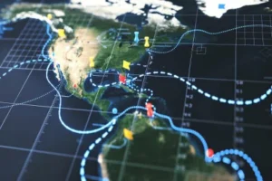
This course provides participants with practical skills in using remote sensing technologies to support climate change adaptation planning, natural resource management, and disaster risk reduction. It focuses on leveraging satellite imagery, aerial data, and geospatial analysis tools to monitor environmental changes, assess vulnerabilities, and design evidence-based adaptation strategies. Through hands-on training, participants will learn how to process and interpret remote sensing data to inform policy, planning, and decision-making in the context of climate resilience.
Target Groups
- Climate change and adaptation planners
- Environmental scientists and ecologists
- Disaster risk reduction (DRR) professionals
- Urban and regional planners
- Natural resource managers
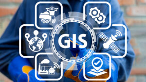
- GIS and remote sensing specialists
- NGO and development practitioners
- Graduate students in environmental science, geography, or planning
Course Objectives
By the end of this course, participants will be able to:
- Understand the role of remote sensing in climate change adaptation.
- Access, process, and analyze satellite imagery for adaptation planning.
- Apply remote sensing techniques to monitor land use, water resources, and ecosystems.
- Conduct vulnerability and exposure assessments using remote sensing data.
- Integrate remote sensing outputs into GIS and decision-support tools.
- Develop adaptation strategies based on geospatial evidence.
- Communicate results effectively through maps, reports, and dashboards.
Course Modules
Module 1: Introduction to Remote Sensing for Adaptation
- Fundamentals of remote sensing technology
- Remote sensing in the context of climate change adaptation
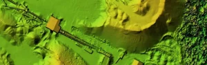
- Types of sensors and platforms (optical, radar, LiDAR, UAVs)
- Key datasets and sources (Landsat, Sentinel, MODIS, etc.)
Module 2: Remote Sensing Data Acquisition & Preprocessing
- Accessing free and open-source satellite data
- Data preprocessing (radiometric, atmospheric, geometric corrections)
- Cloud masking and image enhancement techniques
- Working with multispectral and hyperspectral data
Module 3: Land Use & Land Cover (LULC) Monitoring
- LULC classification methods (supervised, unsupervised, machine learning)
- Monitoring urban growth, deforestation, and agricultural change
- Assessing land degradation and desertification risks
- Case studies in adaptation planning through LULC mapping
Module 4: Remote Sensing for Water & Agriculture
- Monitoring drought and soil moisture
- Irrigation management using remote sensing indices (NDVI, NDWI)
- Flood mapping and hydrological modeling
- Early warning systems for agricultural adaptation
Module 5: Ecosystem & Biodiversity Monitoring
- Forest health and vegetation monitoring
- Habitat mapping and species distribution analysis
- Remote sensing of wetlands and coastal ecosystems
- Applications for ecosystem-based adaptation (EbA)
Module 6: Climate Risk & Vulnerability Assessment
- Identifying exposure and sensitivity through satellite data
- Hazard mapping (drought, floods, heatwaves)
- Integrating remote sensing with socio-economic datasets
- Hotspot identification for targeted adaptation interventions
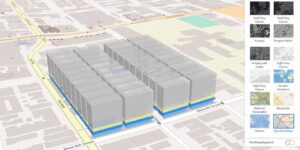
Module 7: Tools & Software for Remote Sensing Applications
- Hands-on training with Google Earth Engine (GEE)
- QGIS and ArcGIS for remote sensing analysis
- SNAP and other open-source remote sensing tools
- Web platforms for data sharing and decision-making
Module 8: Practical Applications in Adaptation Planning
- Case studies: urban climate resilience, agriculture, coastal adaptation
- Developing adaptation indicators from remote sensing data
- Scenario analysis for future planning
- Designing adaptation strategies based on geospatial evidence
Module 9: Visualization & Communication of Results
- Best practices in map design and storytelling
- Developing dashboards for adaptation monitoring
- Communicating scientific outputs to policy-makers
- Building data-driven adaptation reports