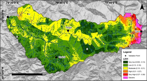
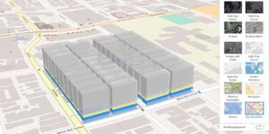
This course equips participants with the knowledge and practical skills required to assess, monitor, and map land degradation and natural resource distribution using Geographic Information Systems (GIS) and remote sensing tools. It focuses on soil degradation, deforestation, desertification, water resource mapping, land cover change analysis, and sustainable land management strategies. Participants will learn how to generate spatial insights that support environmental restoration and resource conservation.
Target Groups
- Environmental scientists and ecologists
- GIS analysts and geospatial technicians
- Land and natural resource managers
- Urban and regional planners
- Agricultural and soil conservation officers
- Climate change and sustainability professionals
- Government environmental agencies
- Students pursuing environmental science, geography, or GIS
Course Objectives
By the end of this course, participants will be able to:
- Understand principles of land degradation and resource mapping
- Identify causes and impacts of land degradation
- Use GIS and remote sensing for land analysis
- Map and monitor natural resource distribution
- Assess soil, water, and vegetation conditions
- Detect land cover and land use changes
- Support sustainable land management decisions
- Develop environmental risk and degradation maps
- Apply spatial analysis for resource conservation
- Communicate environmental findings effectively
Course Modules
Module 1: Introduction to Land Degradation and Resource Mapping
- Definition of land degradation
- Types of land degradation processes
- Importance of resource mapping
- Overview of environmental monitoring systems
- Role of GIS in land management
Module 2: Fundamentals of GIS and Remote Sensing
- GIS concepts and spatial data types
- Raster and vector data applications
- Remote sensing basics
- Satellite imagery interpretation
- Data collection and management
Module 3: Causes and Drivers of Land Degradation
- Deforestation and land clearing
- Soil erosion and desertification
- Urbanization and infrastructure development
- Climate change impacts
- Unsustainable agricultural practices
Module 4: Soil Degradation Mapping
- Soil properties and classification
- Soil erosion assessment techniques
- Soil fertility and quality mapping
- Erosion risk modeling
- Soil conservation strategies
Module 5: Vegetation and Land Cover Analysis
- Vegetation indices (NDVI and related metrics)
- Land cover classification techniques
- Deforestation and reforestation mapping
- Vegetation health monitoring
- Change detection analysis
Module 6: Water and Hydrological Resource Mapping
- Surface water mapping techniques
- Groundwater resource assessment
- Watershed and catchment analysis
- Water quality indicators
- Hydrological modeling basics
Module 7: Spatial Analysis of Land Degradation
- Hotspot identification techniques
- Multi-criteria spatial analysis
- Trend and change detection methods
- Risk assessment modeling
- Spatial correlation analysis
Module 8: Resource Management and Conservation Planning
- Natural resource inventory methods
- Sustainable land management practices
- Conservation prioritization mapping
- Restoration and rehabilitation planning
- Policy and planning integration
Module 9: GIS Tools for Environmental Monitoring
- GIS software for environmental analysis
- Remote sensing platforms and tools
- Mobile data collection systems
- Visualization and mapping dashboards
- Data integration techniques
Module 10: Capstone Project and Case Studies
- Real-world land degradation scenarios
- Group project: mapping degraded land areas
- Resource mapping and analysis exercise
- Case study review of environmental restoration projects
- Emerging trends in AI, satellite monitoring, and sustainable land management technologies