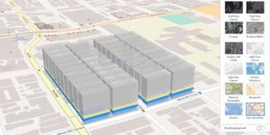
This course equips participants with the knowledge and practical skills required to effectively use Geographic Information Systems (GIS) tools for strategic decision-making. It focuses on spatial data interpretation, map reading, dashboards, geospatial analysis basics, and decision-support systems. Participants will learn how to translate GIS outputs into actionable insights for planning, resource allocation, policy development, and operational efficiency.
Target Groups
- Government planners and policymakers
- Senior managers and executives
- Urban and regional planners
- Disaster management and humanitarian leaders
- Business analysts and decision-makers
- Environmental and infrastructure managers
- Development and NGO program managers
- Students pursuing public policy, GIS, or management
Course Objectives
By the end of this course, participants will be able to:
- Understand the role of GIS in decision-making
- Interpret maps and spatial data effectively
- Use GIS tools for strategic planning
- Apply spatial analysis outputs in decision processes
- Identify trends and patterns using geospatial data
- Improve resource allocation using GIS insights
- Support policy and operational decisions with maps
- Evaluate GIS dashboards and reports
- Communicate spatial information to stakeholders
- Strengthen evidence-based decision-making processes
Course Modules
Module 1: Introduction to GIS for Decision-Making
- Definition and importance of GIS in leadership
- Role of spatial data in decision-making
- Overview of GIS applications across sectors
- Types of spatial information
- Benefits of geospatial decision support
Module 2: Understanding Maps and Spatial Data
- Types of maps (thematic, topographic, digital)
- Reading and interpreting maps
- Coordinate systems and scale
- Understanding spatial relationships
- Data accuracy and reliability
Module 3: Core GIS Concepts for Non-Technical Users
- Vector and raster data basics
- Layers and spatial overlays
- Attribute data interpretation
- Basic spatial relationships
- Introduction to geospatial analysis
Module 4: GIS Tools and Platforms Overview
- Desktop GIS tools overview
- Web-based GIS platforms
- Mobile GIS applications
- Dashboards and visualization tools
- Data sharing and collaboration systems
Module 5: Spatial Analysis for Decision Support
- Buffering and proximity analysis concepts
- Hotspot identification and clustering
- Trend and pattern analysis
- Scenario modeling basics
- Interpreting analytical outputs
Module 6: GIS Dashboards and Visualization
- Understanding GIS dashboards
- Key performance indicators (KPIs) in GIS
- Data visualization techniques
- Interactive mapping tools
- Customizing dashboards for decision-makers
Module 7: Sectoral Applications of GIS
- Urban planning and infrastructure development
- Disaster risk management and response
- Agriculture and food security planning
- Public health and disease mapping
- Business and market analysis
Module 8: Data-Driven Decision-Making
- Converting spatial data into insights
- Evidence-based planning approaches
- Integrating GIS with other data systems
- Scenario comparison and evaluation
- Risk-informed decision-making
Module 9: Communication of GIS Insights
- Presenting maps to non-technical audiences
- Storytelling with spatial data
- Report writing with GIS outputs
- Stakeholder engagement using maps
- Improving clarity in decision communication
Module 10: Capstone Project and Case Studies
- Real-world decision-making scenarios using GIS
- Group project: developing a GIS-based decision dashboard
- Policy and planning case study analysis
- Scenario-based spatial decision exercise
- Emerging trends in GIS for artificial intelligence and smart decision systems