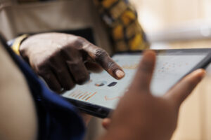
This course equips participants with practical skills to integrate Geographic Information Systems (GIS) with mobile data collection tools for enhanced spatial data analysis and decision-making. It focuses on geospatial data capture, mapping, field data collection using mobile devices, and spatial analysis for humanitarian and development applications. Participants will learn how to collect, visualize, and analyze location-based data for improved planning and response.
Target Groups
- Monitoring and Evaluation (M&E) officers
- GIS analysts and technicians
- Humanitarian and NGO field staff
- Disaster management and emergency response teams
- Government planning and statistics officers
- Public health and epidemiology teams
- Environmental and urban planning professionals
- Research and academic institutions
- Consultants in GIS and data systems
- Students in geography, data science, and development studies
Course Objectives
By the end of this course, participants will be able to:
- Understand fundamentals of GIS and spatial data collection
- Collect georeferenced data using mobile tools
- Integrate GIS with mobile platforms like KoboToolbox and ODK
- Create and manage spatial datasets effectively
- Conduct basic spatial analysis for decision-making
- Visualize data using maps and dashboards
- Improve field data accuracy using GPS-enabled tools
- Apply GIS in humanitarian and development planning
- Strengthen data-driven response and resource allocation
- Develop GIS-based reporting systems
Course Modules
Module 1: Introduction to GIS and Spatial Data
- Definition and importance of GIS
- Types of spatial and non-spatial data
- Applications in humanitarian and development sectors
- Coordinate systems and map basics
- Introduction to GPS technology
Module 2: Introduction to Mobile Data Collection with GIS
- Overview of mobile GIS tools
- Integration of GIS with ODK and KoboToolbox
- Field data collection workflows
- Hardware and software requirements
- Offline and online data collection
Module 3: GPS Data Collection Techniques
- Capturing coordinates using mobile devices
- Accuracy and precision in GPS data
- Waypoints, tracks, and boundaries
- Geotagging photos and survey responses
- Field navigation techniques
Module 4: Designing GIS-Enabled Surveys
- Structuring geospatial questionnaires
- Adding location fields to surveys
- Designing spatial indicators
- Linking survey data with maps
- Improving survey accuracy using GIS logic
Module 5: Data Integration and Management
- Importing and exporting spatial data
- Managing shapefiles and geodatabases
- Cleaning and organizing GIS datasets
- Data formats (GeoJSON, KML, CSV, etc.)
- Data security and backup
Module 6: Spatial Data Analysis
- Basic spatial analysis techniques
- Distance and proximity analysis
- Density mapping and clustering
- Identifying spatial patterns and trends
- Interpreting geospatial results
Module 7: Mapping and Visualization
- Creating thematic maps
- Using GIS software (QGIS/ArcGIS basics)
- Data visualization techniques
- Building interactive maps
- Dashboard integration
Module 8: Field Deployment and Operations
- Planning GIS field surveys
- Managing enumerator teams with GPS tools
- Monitoring field data collection
- Troubleshooting field challenges
- Ensuring data quality in GIS projects
Module 9: Applications in Humanitarian and Development Work
- Disaster response mapping
- Disease outbreak tracking
- Resource allocation and planning
- Infrastructure and service mapping
- Environmental monitoring
Module 10: Capstone Project and Case Studies
- Full GIS-enabled mobile data collection project
- Field mapping simulation exercise
- Spatial data analysis and reporting project
- Real-world humanitarian GIS case studies
- Emerging trends in GIS, AI-powered geospatial analytics, satellite integration, drone mapping systems, real-time location intelligence platforms, and automated spatial decision-support systems